History
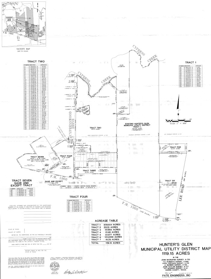
The District is a municipal utility district created by an order of the Texas Water Rights Commission, predecessor state agency to the Texas Natural Resource Conservation Commission and the TCEQ, entered on June 13, 1972, which was confirmed at an election within the District on August 24, 1973, by a vote of 8 for to 0 against. The District operates as a municipal utility district under Chapters 49 and 54 of the Texas Water Code, as amended. Creation of the District was initiated as a means of financing construction of waterworks, sanitary sewage, and drainage facilities to serve the area within the District’s boundaries. The District, as it was originally created, contained 525.479 acres. Since its creation, the District has annexed certain tracts of land under four (4) separate annexations, and the District presently includes approximately 1,119 acres. The District is located in northern Harris County approximately 17 miles north, northeast of the central business district of the City of Houston, Texas (the “City”), approximately three (3) miles west of the central business district of the City of Humble, Texas, and approximately seven (7) miles east of Interstate Highway 45. The District is bounded on the north by Cypress Creek and bounded on the south by F.M. 1960. According to the Engineer, approximately 70 acres of land in the District are located within the 100-year flood plain. However, none of the presently developed land within the District is located in the 100-year flood plain. The District is located wholly within the extraterritorial jurisdiction of the City.
District Map